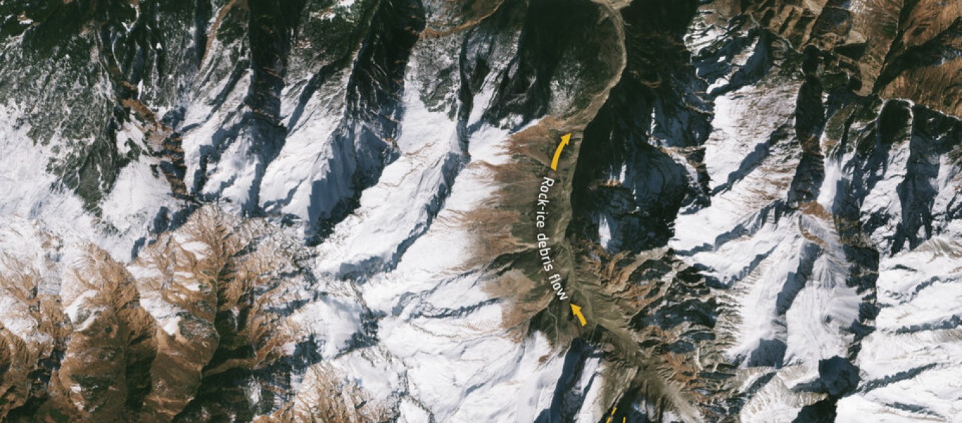
This collapse caused a flow of debris to barrel down the Ronti Gad, Rishiganga, and Dhauliganga river valleys, causing significant destruction along the route, killing more than 200 people and destroying two major hydropower facilities that were under construction.
In response to this, the International Charter 'Space and Major Disasters', a service that provides satellite images in response to natural and human-made emergencies, was activated. The service provides free access to very high-resolution satellite data such as from Worldview 1/2, Cartosat-1 and Pleiades.
Combined with freely available images from Landsat and the Copernicus Sentinel-2 mission, scientists analysed numerous images acquired before and after the event to quickly determine what was going on and quantify key measures of the event, for example its total volume, elevation differences and travel distances.